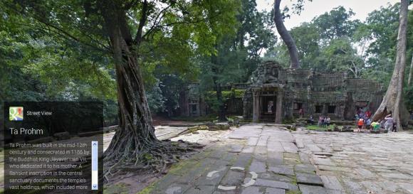
It seems Google Maps and Google Street View is truly unending in their quest to walk around and take panoramic photos of some of the Earth’s most beautiful locations. So far we’ve witnessed the eerie wonder of Gunkanjima and the spectacular sights of Mt. Fuji’s summit all courtesy of Google. And now we are treated to a place found on many people’s bucket list: Angkor, Cambodia.
In a six month period Google has sent its Street View cameras in to chronicle over 100 of the area’s historical sites and deliver it straight to you. Naturally Angkor Wat is there for you to tour. The most famous of Angkor’s landmarks, it’s even printed on the Cambodian flag.
But that’s just the tip of the historical beauty in the region. Just take a stroll through The Banyon and get a close look at the many beautiful reliefs carved through out.
You can even stand atop a pyramid in Koh Ker found in a remote region of Cambodia that’s hard to traverse due to landmines. It appears that didn’t stop the Google crew, nor did it this guy in flip-flops.
And there’s still a whole lot more in this tour using 90,000 images. It could take considerable time to go through click by click, so if your the busy type who wants it quick and dirty, there’s a promotional video and menu of quick links below.
So why not take a moment or several to soak in the rich arts and engineering that has survived over a millennium from what is believed to be the world’s largest pre-industrial city.
Source: Google Asia Pacific Blog (English) via Netlab (Japanese)
Cambodian Flag Image: Wikipedia
Video: YouTube – Google Maps