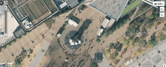
It’s hard to get an idea of how truly massive Tokyo is without seeing it from the sky. Unfortunately, most international flights come into Narita Airport, which is over an hour away from downtown, and we haven’t quite been able to convince our bosses that RocketNews24 really needs a company helicopter.
Thankfully, the newly upgraded Yahoo! Maps lets us take an aerial tour of the city even while we’ve still got both feet firmly on the ground.
On March 10, Yahoo! Japan rolled out a series of clearer, sharper images for the 23 wards of Tokyo, Osaka, and Nagoya. Users can access these new photos, which have twice the resolution of the older set, by setting the zoom to maximum.
Yahoo! Japan has been showing off the new images through its Yahoo! Maps blog, and we decided to take a page from the Internet provider by taking our readers on a whirlwind tour of Tokyo.
Unfortunately, we don’t have enough people on staff to come to all of our readers homes and make helicopter noises while you peruse this article, so instead, just click play and continue reading.
Let’s start with something instantly recognizable, the dramatic silhouette of the full-scale Gundam statue on the island known as Odaiba.
Odaiba is also where you’ll find Big Sight, the convention center that hosts some of Japan’s largest anime and video game conventions and trade shows. Surprisingly, its roof isn’t covered with cosplayers, just a helipad with the building’s name spelled out in giant katakana characters.
We’re starting to get island fever here, though, so let’s head back over to the mainland by taking the Rainbow Bridge.
The bridge spits you out in downtown fairly close to Tokyo Tower, the capital’s older, shorter, more vibrantly colored observation spire.
Since 2010, though, the highest structure in Japan has been the Sky Tree, which was primarily built as a television and radio signal relay.
Tokyo has no shortage of conventional skyscrapers either, though. Somehow we’re not surprised that Roppongi Hills, one of the country’s swankiest shopping centers, is equipped to receive helicopter-riding, high-rolling arrivals.
Here we see Shinjuku’s crazy Cocoon Tower, which at 50 floors tall has plenty of space to house the three universities you can find inside.
More understated educational architecture can be found here, at the clock tower of Waseda University.
If all this talk of studying is making you sleepy. the roof of Tokyo Dome looks like it’d make a cozy spot for a nice late afternoon nap.
What were the odds that the Scramble Intersection in front of Shibuya Station would be filled with people at the exact moment this photograph was taken?
Very good indeed.
Tokyo isn’t all modern urban sprawl, though. You can also find places of cultural significance, like Sensoji Temple in Asakusa.
On the other side of town, there’s the Meiji Shrine, the entrance to which can be found just a few steps outside Harajuku Station.
Even bustling Shinjuku has its quiet patches of verdant splendor, like the pond and pavilion at Shinjuku Gyoen National Garden.
And this regal looking gate? It’s the entrance to the grounds of the Imperial Palace.
Of course, the emperor’s role in present-day Japan is largely symbolic. Far more political decisions are made back in Shinjuku, at the Tokyo Municipal Government Building, also known as Tocho.
Still, if you want to see the true halls of power in Tokyo, where the city’s most powerful and influential individuals gather, there’s really only one place you need to visit.
▼ The RocketNew24 office
Unfortunately, no matter how hard we strain our eyes, we can’t make out Mr. Sato and the rest of our team. Here’s hoping we all make the cut the next time Yahoo! Maps upgrades their images.
Sources: Hatena Bookmark News, Yahoo! Japan
Images: Yahoo! Japan
Video: YouTube