

A beautiful, highly customizable hike that’s an easy day-trip from Tokyo.
We’re finally in that not-too-cold, not-too-hot sweet spot of spring weather in Japan, providing a prime window for all sorts of outdoor activities. While “climb Mt. Fuji” might be the one that most quickly comes to mind for travelers in Japan, the country’s tallest mountain won’t be open to hikers until midsummer, but today we’re taking a look at a different great mountain to hike that’s doable as a day trip from Tokyo.
Mt. Tsukuba is located in the town of Tsukuba, Ibaraki Prefecture. With a height of 877 meters (2,877 feet), it offers some great views from the top, but it can also be a safe, manageable hike even if you’re not a hard-core alpinist. As proof, our Japanese-language reporter Natsuno Futon, who readily admits to not doing a whole lot of exercise these days, recently headed out to Mt. Tsukuba with her two elementary school-age daughters to hike one of its trails.
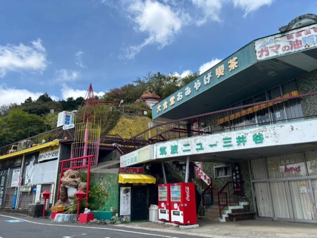
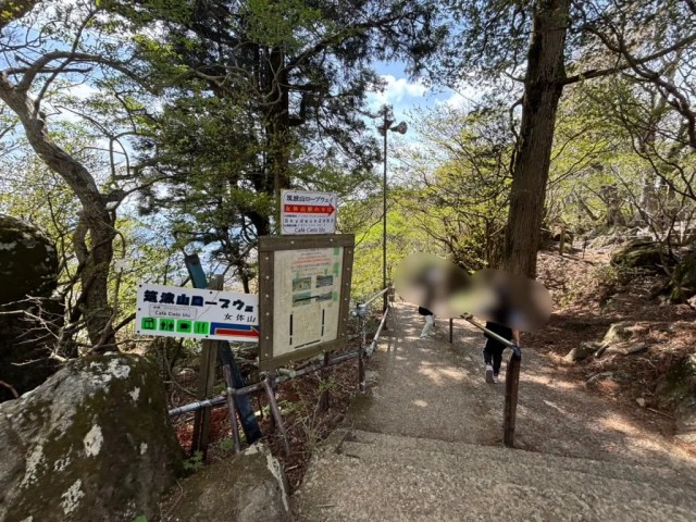
There are a number of different routes you can take to the top of Mt. Tsukuba, but today we’ll be following along on Natsuno’s trek up the Otatsuishi Trail. You can get on the trail from the Tsutsujigaoka Parking Area, which itself can be reached in about two hours from downtown Tokyo, first by taking the Tsukuba Express train from Akihabara Station to TX Tsukuba Station, and from there a series of shuttle buses to the Numata, Tsukubasan-jinja Iriguchi, and finally Tsutsujigaoka bus stops, with 45 minutes spent on the train and a total of about 50 minutes on the buses (alternatively, if you’re arriving by car, you can just drive to the Tsutsujigaoka Parking Area and pay to park in the lot).
Natsuno rolled up at around 11:40 a.m. on a holiday. The parking area is already at an altitude of about 500 meters, so you’re starting off part-way to the top.
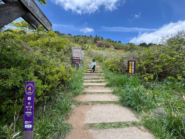
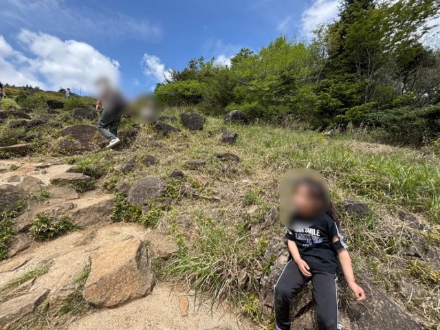
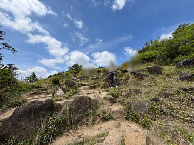
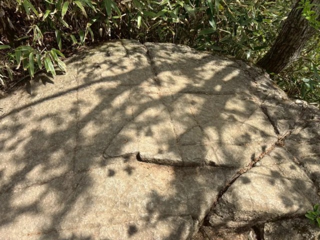
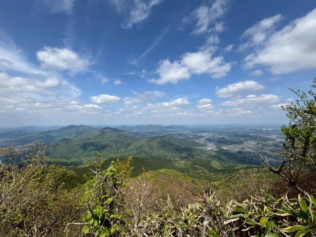
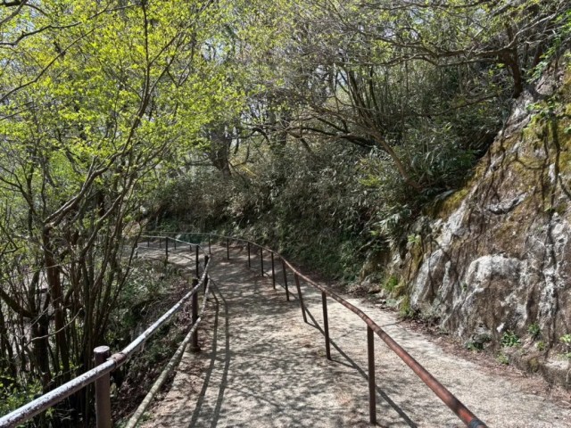
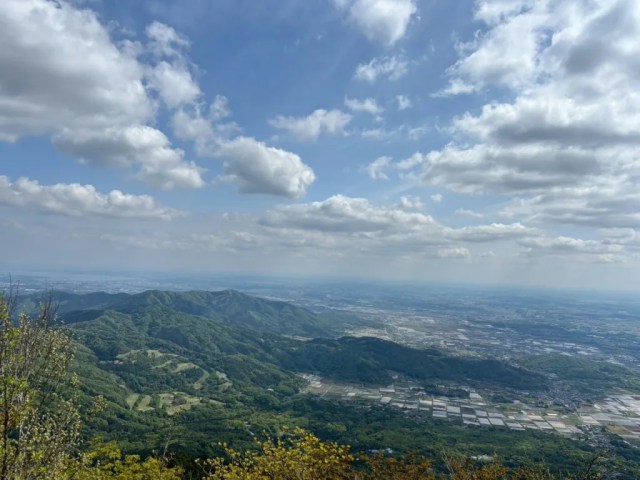
The early section of the trail is a series of paved steps, and less than five minutes after they’d started the hike, they were already being rewarded with beautiful scenery like this.
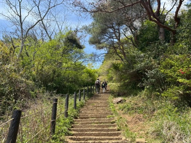
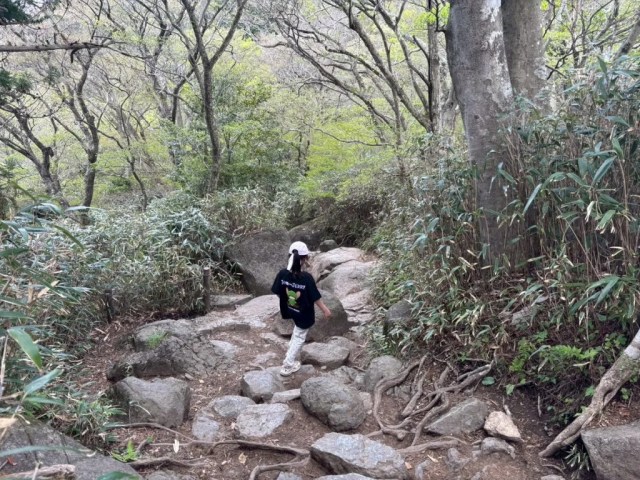
After about 15 minutes of walking, the paved steps had stopped and the course had turned into a genuine trail. Natsuno’s youngest, a first-grader, said “I’m tired” for the first time since they’d set out, so they stopped for short break, then continued on after she’d recharged.
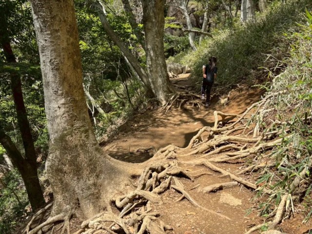
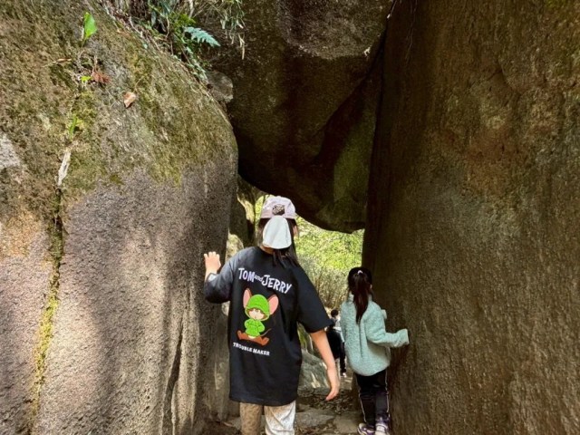
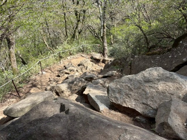
Mt. Tsukuba has a reputation as being a beginner-friendly hike, but you’ll still want to wear proper hiking shoes and watch your step. At around 12:20, Natsuno passed through this section of trees with exposed roots stretching across the path…
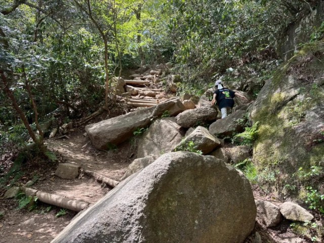
…and this rocky section felt as much like an obstacle course as it did a hiking trail.
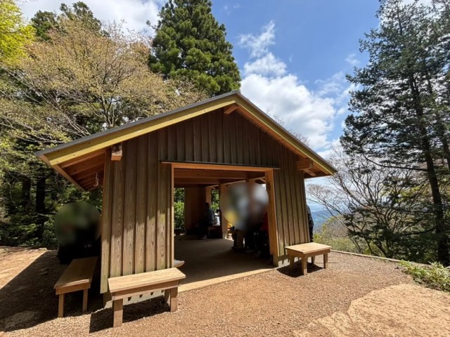
At 12:30, they reached a rest area at on overlook beside the trail. Long ago, this used to be the site of a teahouse, called the Benkei Chaya, and it’s still a place for those walking the trail to stop and rest their feet, though you’ll need to bring your own snacks or drinks to enjoy.
After a 10-minute breather and some munchies, Natsuno was on the move again.
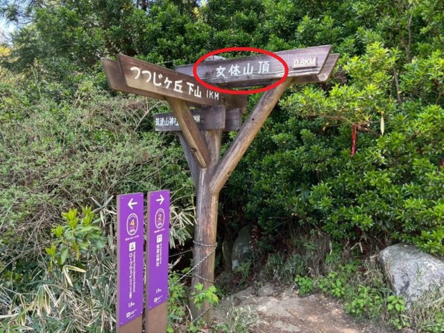
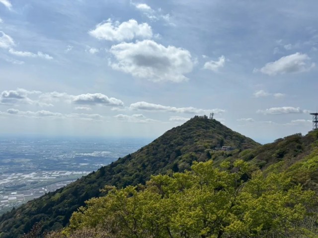
Mt. Tsukuba has a unique shape, with essentially two peaks with a recessed plateau between them. The Nyotaisan, or “Female Peak,” is the higher of the two (877 meters versus the Nantaisan/”Male Peak’s” 871 meters), so when Natsuno’s group came to a fork in the trail, they took the path headed for the Nyotaisan.
▼ 女体山頂 = Nyotaisan peak
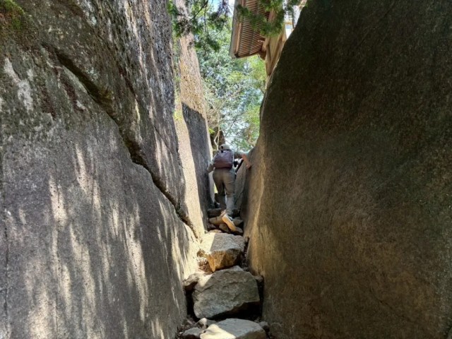
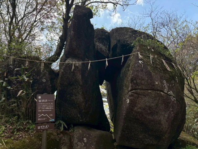
One of the cool things about the Otatsuishi Trail is how many different scenic spots there are along the way. For example, there’s the Benkei Nanamodori.
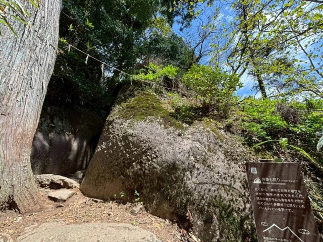
A narrow section of the trail where a large boulder wedged between the tops of two other creates a tunnel-like structure, this was once said to be a gateway between the world of the gods and the world of humans, and Natsuno felt a spark of adventurous excitement as they passed through it.
At 12:43, they reached a section of the trail called Takamagahara, after the “high plain of the heavens” where the sun goddess Amaterasu and other Shinto deities reside.
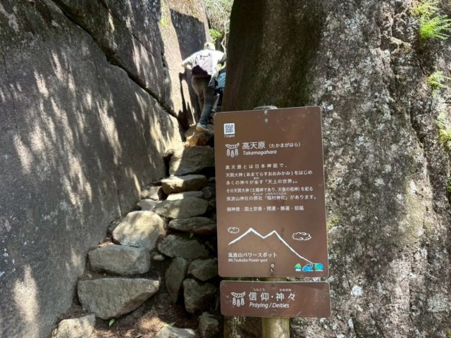
▼ There’s a shrine dedicated to Amaterasu here (you can see part of its roof in this photo).
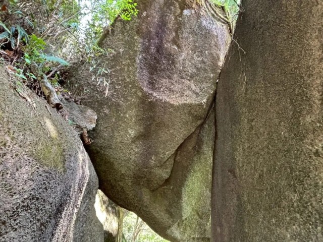
10 minutes later they came upon the Kuniwari Ishi, or “Kingdom-splitting Rock,” where legend has it the gods drew lines upon the stone to determine who would have dominion over which parts of the realm.
And at 12:55, they found themselves at Debune Irebuni, “Ships Coming and Going,” a rock formation that resembles two boats passing by each other, and so a place of worship of Funadama no Kami, the patron deity of ships and sailors.
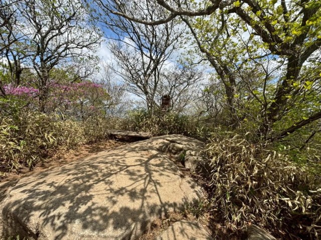
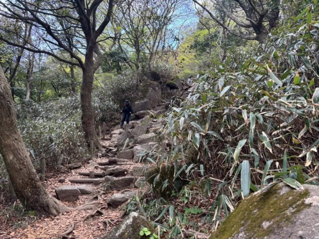
It had been an hour-plus of consistent ascents up to this point, but from here Natsuno got a slight reprieve as the trail sloped back down for a section. However, while she wasn’t having to work herself up and over rocks for a while, she still had to be mindful of her footing, since a slip here would mean a nasty tumble.
Up until now, Natsuno and her group hadn’t encountered many other people on the trail, but a posted sign said that as they got closer to the peak, things might get more crowded. From the point where they were now, it was usually only another 20 minutes or so to get to the top, but during congested times, it could take as much as four times as long.
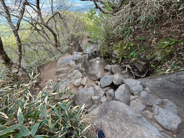
Luckily, things that nearly so severe on this day. As the terrain got super rocky, though, almost like the mountain was giving Natsuno a final test, the slower speed at which hikers could progress did end up causing a bit of a traffic jam right before the peak.
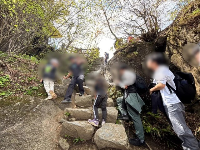
Another part of the reason for this line, though is that people were waiting patiently to take photos at the top of the mountain, which Natsuno’s group got to at 1:24 p.m., about an hour and 40 minutes after they’d started hiking.
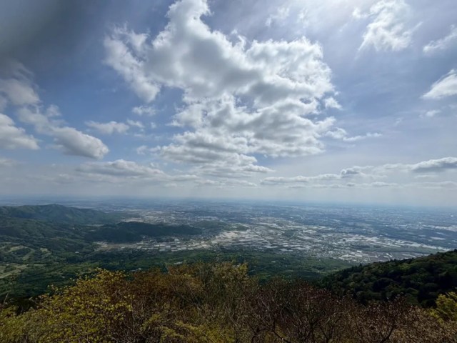
Taking in the breathtaking view and caressed by the cool breeze, Natsuno felt a sense of accomplishment, and her kids had managed the hike pretty well too, even if the youngest had said along the way, more than once, “I’m tired.”
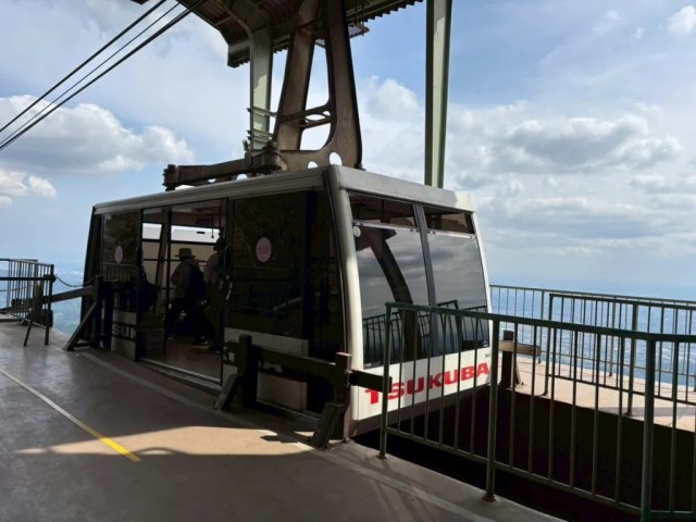
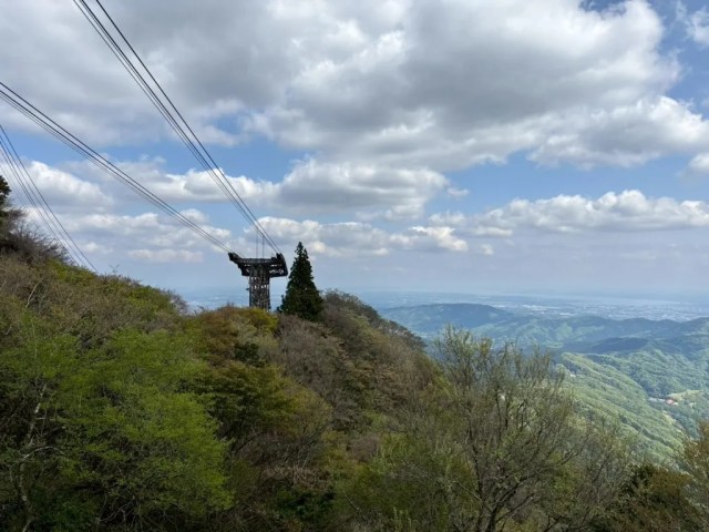
Now, from here you could get back down simply by turning around and waking back the same way you came, or by taking one of the other trails to the bottom. There is, however, a third option, which is to take the ropeway gondolas that run between the peak and the Tsutsujigaoka Parking Area, and in deference to her younger daughter’s sagging energy level (and maybe her own), Natsuno made the decision to ride the ropeway back.
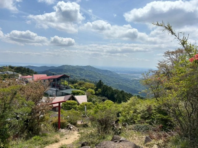
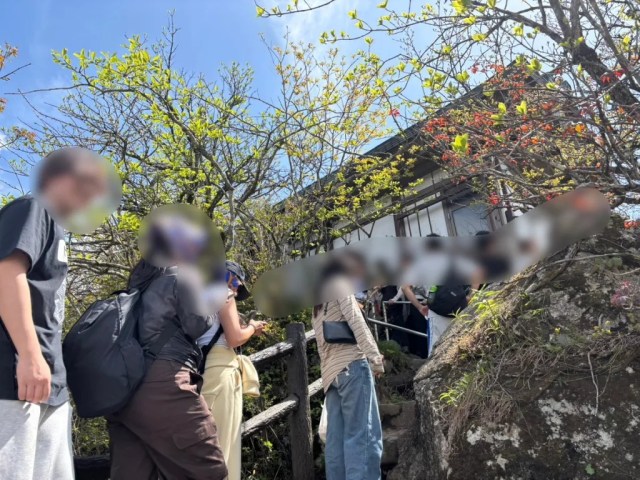
The ropeway station is next to a lookout area with tables and benches, where Natsuno spotted a few well-prepared groups having picnic lunches.
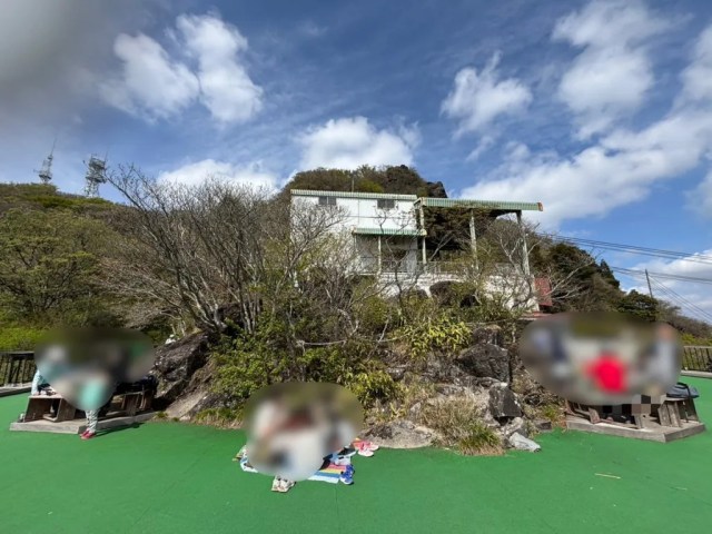
The view from here is amazing too, whether you’re appreciating it with the naked eye or using the coin-operated binoculars.
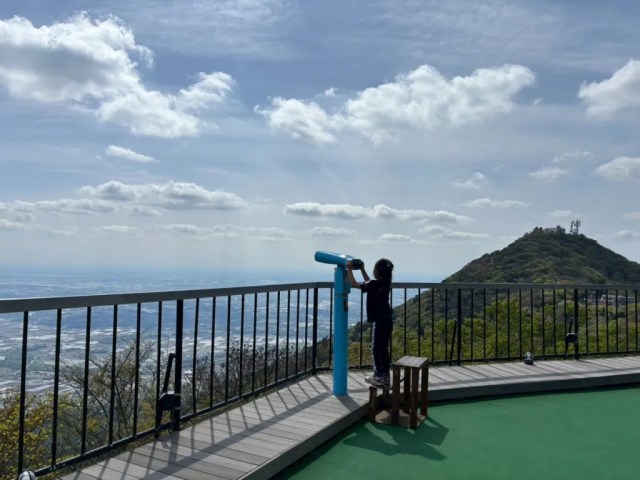
▼ You can also see the slightly lower Nantaisan peak from here.
The ropeway runs between 9:20 a.m. and 5 p.m., and the ride takes a little under 10 minutes.
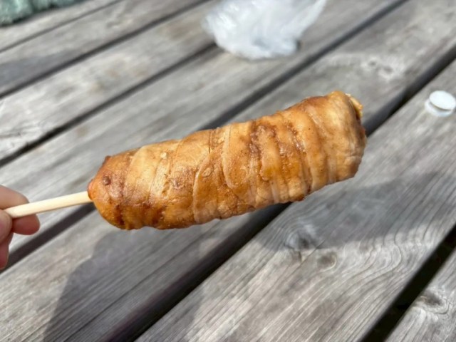
At 2:23, Natsuno’s group was back at the Tsutsujigaoka Parking Area, where they rewarded themselves for their hike to the summit with some meat-wrapped rice balls on a stick and fried chicken cutlets.
▼ Mountain climbing is hungry work, after all.


Though Natsuno’s group took around an hour and 40 minutes to hike their way up, serious adult hikers can do the Otatsuishi Trail ascent in about 40 minutes, so walking it both ways, up and down, is still a very doable day trip. There are also longer trails that start lower on the mountain, plus one that connects the mountain’s two peaks, which are about 35 minutes apart on foot. All of that makes Mt. Tsukuba a very customizable hike, and a great way to get a taste of mountain trekking in Japan.
Related: Mt. Tsukuba official website, Mt. Tsukuba Cable Car and Ropeway official website
Photos ©SoraNews24
● Want to hear about SoraNews24’s latest articles as soon as they’re published? Follow us on Facebook and Twitter!
[ Read in Japanese ]