The tiny shaded part of each map represents half of the population.
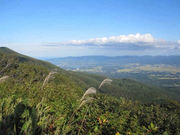
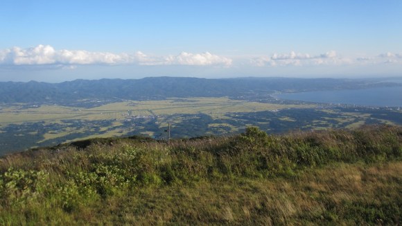
Is Japan crowded? The answer really depends on where you go. On the one hand, Japan is the nation of comically packed rush hour commuter trains, but it’s also where you’ll find views like these.
Different parts of Japan have vastly different population densities, something that’s a result of both geographical and historical factors. The country’s mountainous topography has always limited where towns can be built, and during Japan’s protracted feudal era, restrictions on the flow of goods and people meant that resources clustered around the local warlord’s stronghold. Many of Japan’s present-day urban centers, including Tokyo, Osaka, Nagoya, and Hiroshima can trace their lineage back to a period of being a castle town, and even in the post-samurai age, they represent the greatest abundance of economic and educational opportunities.
To illustrate just how concentrated Japan’s population distribution is, Twitter users have taken to creating infographics that show a prefecture filled in with two colors, each representing half of the area’s residents. For example, Chiba Prefecture, Tokyo’s neighbor to the east, is home to some 6.2 million people, but half of them live just a stone’s throw away from the nation’s capital, in the area marked in red on the map below.
千葉県の人口2分割です pic.twitter.com/Wa254X585F
— みながれ (@Mina_akagi) November 25, 2016
North of Tokyo, you’ll find a pretty similar situation in Saitama Prefecture.
埼玉県を同じ人口で二分割するとこうなる
— LaTeX Glaceon(ラテグレ) (@latex_glaceon) November 25, 2016
っていうか、しゅうちゅうしすぎて、3分割になる pic.twitter.com/q5CGf676qT
Heading over to central Japan, Nara Prefecture has plenty of cool places to visit. Just about everyone wants to live at the north tip, though, in the prefectural capital of Nara City, which is linked by quick rail access to Osaka and Kyoto.
奈良県を、人口が(だいたい)等しくなるように2つに分割してみた pic.twitter.com/erX1EaYu7G
— らび (@ibaruyan) November 25, 2016
Another Osaka neighbor, Wakayama Prefecture, also has everyone wanting to find homes as close as possible to the border with the Kansai region’s largest city, located to Wakayama’s north.
https://twitter.com/ruta_q/status/802003291622080513Gifu Prefecture is seeing a huge influx of visitors coming to see the setting of some of anime hit Your Name’s most pivotal scenes, but most of the people who live there want to be situated close to Nagoya, across the prefectural line to the south in Aichi Prefecture.
https://twitter.com/ruta_q/status/802012993131155456Sometimes, though, a prefecture’s population gathers in its middle, like in Miyagi Prefecture, where capital city Sendai and neighboring municipality Natori together claim 50 percent of the prefectural population.
奈良県の人口2分割が話題になってるけど宮城県も大概だと思う pic.twitter.com/Gf25oXoL4X
— つくも (@kogasaLv96) November 25, 2016
And how does everything look when we zoom out to the national level? In the illustration below, those tiny blue areas represent half of Japan’s populace, with the scattered dark red spots accounting for an additional 25 percent, and the remaining quarter of the country’s residents spread out over the pink zones.
なんか人口二分割が流行ってるみたいなので全国版でやってみた。日本では青い部分に人口の半分が住んでいます。青い部分と濃い赤部分を合わせると人口の75%が住んでいます。青い面積は合わせると岩手県よりちょい広いくらいです。人口の集中っぷりが顕著ですね。 pic.twitter.com/dGMjn5tYwL
— Simon_Sin (@Simon_Sin) November 26, 2016
So really, most of Japan isn’t very crowded at all, as there are several points on the map where you’d have hardly any close neighbors at all. If you want to be near one of the big cities, though, well, let’s just say we hope you’re a people person, because you’re going to be dealing with a lot of them every day.
Source: IT Media, Twitter/@Simon_Sin
Top, insert image ©RocketNews24
Follow Casey on Twitter, where he feels like the population density in his part of Yokohama is just right.


 Crazy huge crowd of otaku, rockers, and sports fans forms at Japanese train station【Photos】
 The crazy huge crowds of Summer Comiket【Photos, videos】
 Daily horde of commuters into Tokyo is larger than one of history’s fiercest conquering armies
 Amazing castle photo ever shows why you shouldn’t skip this often-overlooked part of Japan
 Take a trip to Japan’s Dododo Land, the most irritating place on Earth
 7-Eleven Japan sells freshly baked pizzas…but are they any good?
 Family Mart releases huge range of cute sweets for Cat Day in Japan
 Second-hand video game fukubukuro lucky bags reveal nostalgic surprises
 Downloads of 39-year-old Guns N’ Roses song increase 12,166 percent thanks to Gundam
 Hachiko, Japan’s most loyal dog, finally reunited with owner in heartwarming new statue in Tokyo
 Draw like a Studio Ghibli anime artist with exclusive watercolour set approved by Hayao Miyazaki
 Camera crew visits the abandoned town that inspired Japanese survival horror game “Siren”【Video】
 Häagen-Dazs brings back its popular mochi ice cream line with two classic, luxurious flavors
 Father and son dissect a gachapon capsule toy machine to show us its magical insides【Video】
 Is China’s don’t-go-to-Japan warning affecting the lines at a popular Tokyo gyukatsu restaurant?
 Three beautiful places to see Japan’s plum blossoms after starting your day in downtown Tokyo
 Cherry blossom forecasts map shows Japan’s OTHER sakura season is starting right now
 Yokai are descending upon Tokyo this spring in the latest immersive art experience
 New Studio Ghibli stamps leave an impression on your stationery…and your heart
 Japanese women sound off on their minimum height requirements for a husband【Survey】
 Huge Evangelion Unit-01 head appearing in lights in Japan to celebrate anime’s 30th anniversary
 Kyoto planning surprise late-night inspections of Airbnb-style rentals to fight overtourism
 Starbucks Japan releases new drinkware and goods for Valentine’s Day
 Japan releases first official sakura cherry blossom forecast for 2026
 Archfiend Hello Kitty appears as Sanrio launches new team-up with Yu-Gi-Oh【Pics】
 Starbucks Japan releases new Frappuccino and latte for Valentine’s Day
 China’s don’t-go-to-Japan warning looks to be affecting tourist crowds on Miyajima
 Our 52-year-old pole dancing reporter shares his tips for achieving your New Year’s exercise goal
 10 times to avoid traveling in Japan in 2026
 Studio Ghibli releases new “komorebi” plush toys from Princess Mononoke and Spirited Away
 Survey asks foreign tourists what bothered them in Japan, more than half gave same answer
 Japan’s human washing machines will go on sale to general public, demos to be held in Tokyo
 We deeply regret going into this tunnel on our walk in the mountains of Japan
 Studio Ghibli releases Kodama forest spirits from Princess Mononoke to light up your home
 Major Japanese hotel chain says reservations via overseas booking sites may not be valid
 Put sesame oil in your coffee? Japanese maker says it’s the best way to start your day【Taste test】
 No more using real katana for tourism activities, Japan’s National Police Agency says
 Starbucks Japan reveals new sakura drinkware collection, inspired by evening cherry blossoms
 Updated cherry blossom forecast shows extra-long sakura season for Japan this year
 Is this Japanese train crowded? Question divides the nation
 Commuter chaos at Shibuya Station after glass window breaks on door of crowded Japanese train
 What pandemic? Onsen towns, hiking trails and theme parks packed with crowds on four-day weekend
 Amazing time-lapse-style video shows 150-year history of the growth of train stations in Japan
 Idol draws such massive crowds at Tokyo college that police can’t guarantee safety【Video】
 And now, the story of a smelly fart on a crowded Japanese commuter train
 10 tweets showing just how crazy snow can make things in Tokyo
 Massive blizzard creates crazy snow scenes in Sapporo【Photos, videos】
 Infographic captures gamers’ frustration at DLC, but forgets some key points of video gaming past
Leave a Reply