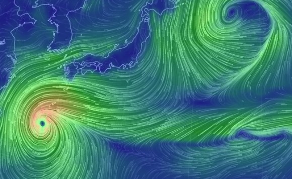
As of this writing Typhoon 19 is just about right on top of Okinawa. Classified as a “Super Typhoon” by NASA it is far greater in size and power than last week’s storm. The typhoon also goes by the name Vongfong, which we assume is Chinese for “killjoy” because of its incredibly bad timing.
If Typhoon 19 veers East and moves across most of Japan, it will do so right over the long weekend. With all the destruction and at very least wet nuisances brought by typhoons, the one sliver of light had always been that they often brought days off work and school with them too. Not this weekend, however, and many wait to see whether the weather will dash their holiday plans or not.
Luckily there is a plethora of online weather services for us to watch Typhoon 19 in near-real-time that are all both very informative and gorgeous enough to make you want to refer to them even after the storm has passed.
■ Hourly satellite monitoring
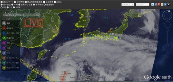
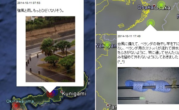
First up is a service that allows you to watch Typhoon 19’s progress hourly right from the comfort of your web browser. In addition to the overall map you can also view reports from all over Japan such as heavy rain and strong winds in Okinawa as well as slipper securing tips from Osaka.
To use this service you will need to install the Google Earth plug-in to your browser if you haven’t already. It doesn’t take long though and is a handy service if you want a very clear view of where the typhoon is and how it’s moving.
■ Watch the wind on “Earth”
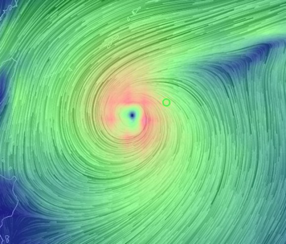
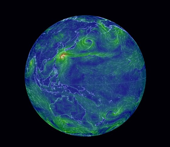
Although the Google Earth image is highly detailed, it’s static and doesn’t really capture the intensity of the storm. For that we have “Earth” which shows us an animated view of all the winds around the globe. We can watch both the direction and intensity of Typhoon 19 in relation to all the other winds in the world. Zooming into the eye of Vongfong gives us an uncomfortable image.
However, under better circumstances, watching the animated wind of the world is both fascinating and breathtakingly beautiful. After Typhoon 19 is said and done, this is definitely a website worth visiting again.
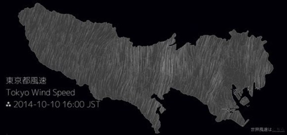
There is also a version of this wind animation made only for Tokyo if you happen to live there.
■ Have you ever seen the rain?
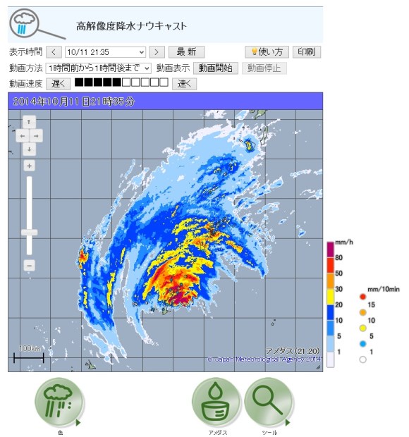
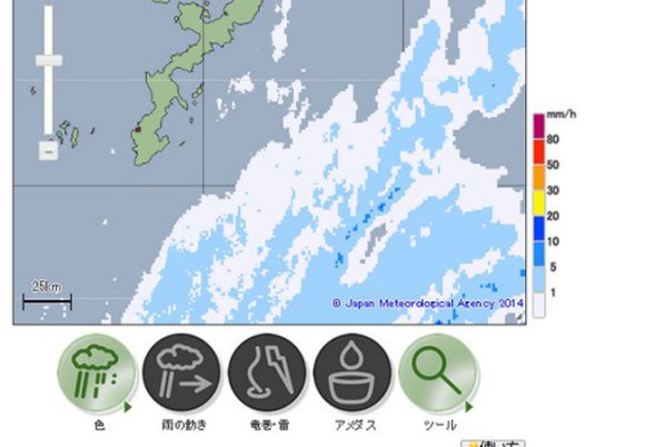
While it lacks the sexiness of the first two services, this map from the Japan Meteorological Agency more than makes up for it in usefulness. This map gives the updated amount of precipitation every five minutes. Not only that, but it offers a 60-minute forecast on precipitation in your area no matter where you are in Japan. It will also give you tornado and lightning information if you zoom in close enough.
This might prove to be the most valuable of resources should Typhoon 19 move across all of Japan. It can show you when pockets of lighter rain are likely to occur if you need to go out for supplies. It can also warn areas hit by heavy rain from last week’s typhoon if more is on the way. This can be a matter of life and death as back to back typhoons may run the risk of landslides or flooding in some areas.
Let’s hope it doesn’t come to that though and keep our fingers crossed that Vongfong will just bank East extra sharply and fly back off into the Pacific leaving further inhabited areas unscathed. Either way, thanks to all this technology at our disposal, there’s no chance this massive storm will get the jump on us.
Source: NASA, Typhoon Real Time Watcher, Earth, High-Res Precipitation Nowcasting, NHK
▼ An image of Typhoon 19 from NASA
Super Typhoon #Vongfong seen Oct 9 as it moved north through the Philippine Sea. Latest: http://t.co/7zk27CuVcg pic.twitter.com/TTKns0Uob3
— NASA (@NASA) October 9, 2014
▼ And a particularly ominous one from MTSAT-2
First light MTSAT-2 visible image of Super Typhoon Vongfong http://t.co/doflJkb3gV pic.twitter.com/XOzQS295sQ
— Scott Bachmeier (@CIMSS_Satellite) October 7, 2014
[ Read in Japanese ]


 Nagano Prefecture dodges yet another typhoon – Does it have some kind of magical force field?
 Astronaut’s assessment of Super Typhoon Trami isn’t filling us with confidence
 Typhoon Trami batters Japan, hits close to Tokyo with fierce winds 【Photos & Videos】
 Typhoon Jebi hits too close to home, wreaks havoc on my Osaka neighborhood【Videos】
 Typhoon Faxai makes landfall in Japan, batters Tokyo area 【Pics & Video】
 Tokyo Skytree turns pink for the cherry blossom season
 Highest Starbucks in Japan set to open this spring in the Tokyo sky
 The 10 most annoying things foreign tourists do on Japanese trains, according to locals
 Japanese zoo’s monkey bonds with Ikea stuffed orangutang following abandonment by mother[Video]
 Saitama is home to the best strawberries in Japan that you’ve probably never even heard of
 These are Tokyo train lines people most want to live along【Survey】
 One of Japan’s oldest castles now lets travelers spend night on the grounds, drink in its keep
 Tokyo train little luxury showdown – Green Car vs. Kaiji, which is more comfortable?
 Japanese potato chip Rubik’s Cubes coming soon
 Believe it! Naruto live-action stage play returns, shows off huge new cast and costumes【Photos】
 Starbucks Japan releases new sakura goods and drinkware for cherry blossom season 2026
 Naruto and Converse team up for new line of shinobi sneakers[Photos]
 Is Sapporio’s Snow Festival awesome enough to be worth visiting even if you hate the snow? [Pics]
 Japan has trams that say “sorry” while they ride around town…but why?
 Sakura Totoro is here to get spring started early with adorable pouches and plushies
 Starbucks Japan unveils new sakura Frappuccino for cherry blossom season 2026
 Poop is in full bloom at the Unko Museums for cherry blossom season
 Now is the time to visit one of Tokyo’s best off-the-beaten-path plum blossom gardens
 Playing Switch 2 games with just one hand is possible thanks to Japanese peripheral maker
 Japan’s newest Shinkansen has no seats…or passengers [Video]
 Foreigners accounting for over 80 percent of off-course skiers needing rescue in Japan’s Hokkaido
 Super-salty pizza sends six kids to the hospital in Japan, linguistics blamed
 Foreign tourists in Japan will get free Shinkansen tickets to promote regional tourism
 Take a trip to Japan’s Dododo Land, the most irritating place on Earth
 Archfiend Hello Kitty appears as Sanrio launches new team-up with Yu-Gi-Oh【Pics】
 Survey asks foreign tourists what bothered them in Japan, more than half gave same answer
 Japan’s human washing machines will go on sale to general public, demos to be held in Tokyo
 Starbucks Japan releases new drinkware and goods for Valentine’s Day
 We deeply regret going into this tunnel on our walk in the mountains of Japan
 Studio Ghibli releases Kodama forest spirits from Princess Mononoke to light up your home
 Major Japanese hotel chain says reservations via overseas booking sites may not be valid
 Put sesame oil in your coffee? Japanese maker says it’s the best way to start your day【Taste test】
 No more using real katana for tourism activities, Japan’s National Police Agency says
 Nude photos of Mt. Fuji circulate online as powerful typhoon removes snow from the peak【Photos】
 Typhoon Jebi hits Japan, blows away cars, roofs, and building facades 【Pics & Videos】
 Typhoon warning from NHK Japan “to all foreigners” causes controversy online
 One bizarre Japanese trading card gets a literal strength bonus from this weekend’s typhoon
 Yayoi Kusama’s Yellow Pumpkin washed away during typhoon in Japan
 Typhoon Faxai strands thousands at Narita Airport in Japan【Pics & Video】
 Drenched in passion – Makoto Shinkai’s Weathering with You is here, but is it good?【SoraReview】